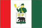
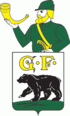
Chernyakhovsk
 |
 |
Insterburg was founded in 1336 by the Teutonic Knights on the site of a former Old Prussian fortification when Dietrich von Altenburg, the Grand Master of the Teutonic Knights, built a castle called Insterburg following the Prussian Crusade. During the Teutonic Knights' Northern Crusades campaign against the Grand Duchy of Lithuania, the town was devastated in 1376. The castle had been rebuilt as the seat of a Procurator and a settlement also named Insterburg grew up to serve it. In 1454, Polish King Casimir IV Jagiellon incorporated the region to the Kingdom of Poland upon the request of the anti-Teutonic Prussian Confederation. During the subsequent Thirteen Years' War (1454–1466) between Poland and the Teutonic Knights, the settlement was devastated by Polish troops in 1457. After the war, since 1466, the settlement was a part of Poland as a fief held by the Teutonic Knights.
When the Prussian Duke Albert of Brandenburg-Ansbach in 1525 secularized the monastic State of the Teutonic Order per the Treaty of Kraków, Insterburg became part of the Duchy of Prussia, a vassal duchy of the Kingdom of Poland. The settlement was granted town privileges on 10 October 1583 by the Prussian regent Margrave George Frederick. Insterburg became part of the Kingdom of Prussia in 1701, and because the area had been depopulated by plague in the early 18th century, King Frederick William I of Prussia invited Protestant refugees who had been expelled from the Archbishopric of Salzburg to settle in Insterburg in 1732. During the Seven Years' War, the town was occupied by Russia. During the Napoleonic Wars, French troops passed through the town in 1806, 1807, 1811 and 1813.
In 1818, after the Napoleonic Wars, the town became the seat of Insterburg District within the Gumbinnen Region. Michael Andreas Barclay de Tolly died at Insterburg in 1818 on his way from his Livonian manor to Germany, where he wanted to renew his health. In 1863, a Polish secret organization was founded and operated in Insterburg, which was involved in arms trafficking to the Russian Partition of Poland during the January Uprising. Since May 1864, the leader of the organization was Józef Racewicz. Insterburg became a part of the German Empire following the 1871 unification of Germany, and on May 1, 1901, it became an independent city separate from Insterburg District. During World War I the Russian Army seized Insterburg on 24 August 1914, but it was retaken by Germany on 11 September 1914. The Weimar Germany era after World War I saw the town separated from the rest of the country as the province of East Prussia had become an exclave. The association football club Yorck Boyen Insterburg was formed in 1921. During World War II, the Germans operated the Stalag 336 prisoner-of-war camp for Allied POWs in the town. The town was heavily bombed by the British Royal Air Force on July 27, 1944. The town was stormed by Red Army troops on January 21–22, 1945. As part of the northern part of East Prussia, Insterburg was transferred from Germany to the Soviet Union after the war as previously agreed between the victorious powers at the Potsdam Conference. On 7 April 1946, Insterburg was renamed as Chernyakhovsk in honor of the Soviet World War II Army General, Ivan Chernyakhovsky, who commanded the army that first entered East Prussia in 1944.
After 1989, a group of people introduced the Akhal-Teke horse breed to the area and opened an Akhal-Teke breeding stable.
Map - Chernyakhovsk
Map


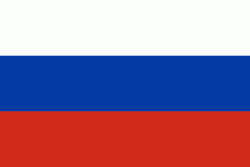
Country - Russia
 |
 |
| Flag of Russia | |
The East Slavs emerged as a recognisable group in Europe between the 3rd and 8th centuries CE. The first East Slavic state, Kievan Rus', arose in the 9th century, and in 988, it adopted Orthodox Christianity from the Byzantine Empire. Rus' ultimately disintegrated, with the Grand Duchy of Moscow growing to become the Tsardom of Russia. By the early 18th century, Russia had vastly expanded through conquest, annexation, and the efforts of Russian explorers, developing into the Russian Empire, which remains the third-largest empire in history. However, with the Russian Revolution in 1917, Russia's monarchic rule was abolished and replaced by the Russian SFSR—the world's first constitutionally socialist state. Following the Russian Civil War, the Russian SFSR established the Soviet Union (with three other Soviet republics), within which it was the largest and principal constituent. At the expense of millions of lives, the Soviet Union underwent rapid industrialization in the 1930s, and later played a decisive role for the Allies of World War II by leading large-scale efforts on the Eastern Front. With the onset of the Cold War, it competed with the United States for global ideological influence; the Soviet era of the 20th century saw some of the most significant Russian technological achievements, including the first human-made satellite and the first human expedition into outer space.
Currency / Language
| ISO | Currency | Symbol | Significant figures |
|---|---|---|---|
| RUB | Russian ruble | ₽ | 2 |
| ISO | Language |
|---|---|
| CE | Chechen language |
| CV | Chuvash language |
| KV | Komi language |
| RU | Russian language |
| TT | Tatar language |